Trun-Sumvitg valley tour
Medium
24.8 km
3:30 h
730 mhd
730 mhd


Show all 6 images

This beautiful and partly technical circular tour starts and ends in Trun. The route leads along the young Rhine and into the Val Russein. The return journey is via the beautiful southern slopes of Sumvitg back to Trun.
Best Season
Jan
Feb
Mär
Apr
Mai
Jun
Jul
Aug
Sep
Okt
Nov
Dez
Start
Trun train station
Destination
Trun train station
Coordinates
46.742705, 8.990542
Details
Description
From Trun train station, head towards Camping Trun and follow the “1 Alpine Bike” mountain bike route towards Disentis. The gentle climb through the alder forests along the young Rhine is ideal for warming up for the steep ascent into Val Russein. In Madernal, leave the “1 Alpine Bike” route and follow the “208 Val Russein” mountain bike route. At the main road, you first pass the wooden bridge, which is over 150 years old. It is one of three bridges in the immediate vicinity. The old wooden bridge, a road bridge and a railroad bridge. After five more hairpin bends, you reach point 1222, where the sometimes tricky singletrail turns right towards Sumvitg. After the singletrail pass, the second ascent follows on gravel and tarred roads towards Sogn Benedetg. From S. Benedetg, the route leads mainly over various singletrails down to Rabius and on to Campliun. Now begins the last short ascent to the Nossadunna dalla Glisch chapel, before returning to the starting point in Trun via the Cartatscha avalanche dam.
Hidden Gem
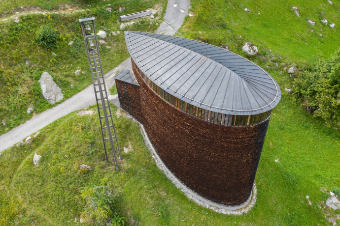
A visit to the Caplutta / Sogn Benedetg chapel by star architect Peter Zumthor is a must on this route.
In terms of biking, this highlight of the region should not be missed: Bike park, climbing wall and Igniu barbecue area/playground near Rabius. A must before or after the tour.
Safety Note
Respect other trail users - trail tolerance!
ATTENTION the trails are not suitable for families!
The tour should not be undertaken in uncertain weather conditions. Weather changes are frequent in the mountains. If a rain front or similar is approaching during the hike, you should turn back in good time.
144 Emergency call, first aid
1414 Mountain rescue REGA
112 International emergency call
Equipment
Mountain bike, helmet, gloves, bike shoes, goggles, rain and sun protection, drink, repair kit, first aid kit
Directions
Train Station Trun - Plaun Rensch - Surrein - Plaun Petschen - Falens - Pardomat - Madernal - Lumbreiner Bridge - Malpass - Point 1222 - Barcuns Dado - Pigniu - Canariel - Cischlun - S. Benedetg - Campieschas - Cumadé - Rabius - Campliun - Nossadunnaa - Avalanche Dam Cartatscha - Train Station Trun
Directions
Public Transport
From the Grisons cantonal capital of Chur, take the Rhaetian Railway through the spectacular Rhine Gorge to Ilanz and on to Trun.
Travel Information
Take the A13 to Reichenau, then the main road 19 via Flims to Ilanz and on to Trun.
Parking
Parking at Trun train station
Responsible for this content: Surselva Tourism.
This content has been translated automatically.

This website uses technology and content from the Outdooractive platform.


