Steinmandli - route


Show all 10 images

A Steinmandli colony is waiting to be expanded with more original constructions. T2
Details
Description
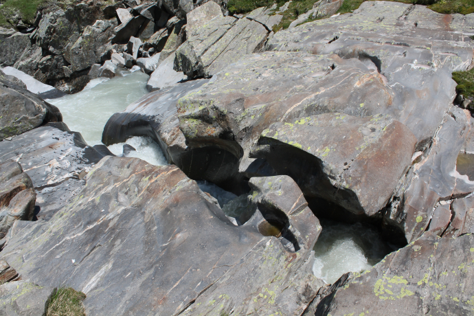
With creative ideas in mind, we begin our hike at the Oberalppass, into the Val Maighels. Along the way, we enjoy the diverse alpine flora with Turk's cap lily or purple gentian, bubbling mountain streams and clear blue mountain lakes. On the plain Plidutscha we cross the young Rhine, which here still flows down as a lively brook. And after the lakes Lai Urlaun and Lai Carin, we reach the Piogn Crap, where the water of the Rein da Maighels is squeezed through a narrow crevice in the rock. Caution is advised, there are no safety facilities.
With a view of the Bornengopass, we continue hiking past the turn-off to the Maighel Pass until we reach the plain Grava. Here they are! The numerous small and large Steinmandli which have been built over the years by hikers during a rest. We soon get to work because we can immediately see there are still plenty of stones. It is fun to enrich the colony with another object and to bring joy to following hikers.
Hidden Gem
A visit to the Maighel hut is worth it. Here you can get coffee and cake with a view.
Safety Note
Fairtrail: From Maighels, hikers share the path with mountain bikers.
Care is needed if you step over the roaring waters at Piogn Crap.
Equipment
Well-groomed hands like to be protected with gloves.
Directions
We follow the marked hiking trail from the Oberalppass to Lake Toma and the Maighel hut. However, we walk below Lake Toma and the Maighel hut past towards Bornengo - and Maighel Pass. We also pass the Maighel Pass junction until we reach the Grava plain after about 15 minutes. The return journey is made on the exact same route.
Directions
Public Transport
Travel Information
Parking
Responsible for this content: Sedrun Disentis Tourism SA.

This website uses technology and content from the Outdooractive platform.

