Auf Suworows Spuren

Simple
24.7 km
1:45 h
637 mhd
644 mhd
Auf Suworows Spuren
Auf Suworows Spuren

Show all 10 images

Staumauer am Lag da Pigniu

Grey and mighty the rock colossi above, turquoise and lovely the lake below. The scenically unique family bike tour offers a lot of riding pleasure and lets you quickly forget how relentless the mountains may have been in the 18th century.

Technique 1/6
Fitness 2/6
Highest Point  1458 m
Lowest Point  1092 m
Best Season
Jan
Feb
Mär
Apr
Mai
Jun
Jul
Aug
Sep
Okt
Nov
Dez
Start
Valley station Bergbahnen Brigels
Destination
Waterfalls at Lag da Pigniu (same way back)
Coordinates
46.770994, 9.067156

Details

Description

The paint of the shadowy soldiers slowly peels off the reservoir wall, the memory remains. It must have been quite uncomfortable when the famous Russian general Alexander Vasilyevich Suvorov rescued his army from the advancing French over the already snow-covered Panixer Pass from Glarus to Graubünden in the late autumn of 1799. The three-thousand-metre peaks Muttenstock, Ruchi, Chli Ruchi and Hausstock, which probably seem threatening to the exhausted soldiers, form a spectacular backdrop for the circumnavigation of the Lag da Pigniu today.

The route starts at the valley station in Brigels. Follow the bike route no. 90 Graubünden Bike.

On the bike route no. 90 Graubünden Bike, you go on the left bank of the lake in the direction of Waltensburg. Continue until you reach the Waltensburg valley station (large parking lot). At the valley station you ride uphill to Andiast. Now drive through the beautiful mountain village to the end of the village. Here you will find a fork. Take the road on the left and continue along the number 90 until you reach the main road between the village of Pigniu and the reservoir. Now you have to follow the No. 225 Lag da Pigniu. Once at the reservoir, you can drive on the gravel road to the waterfalls at the end of the lake. The picnic areas at the end of the lake and on the other side of the dam are excellent places to take a break. The way back is via the same route back to Brigels.

Geheimtipp

Climbing wall at the dam (via the mentioned painting), bookings under Tel.: 0041 79 256 36 36, www.alpventura.ch

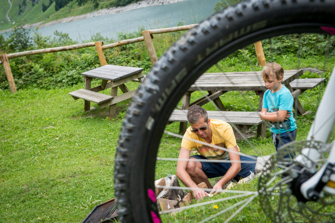
Fire pits at the end of the reservoir in the middle of the rock arena or at the western end of the dam wall with a lot of panorama.

On the east side of the reservoir (Singetrail) there is a driving ban for bikes for safety reasons. Please adhere to this. Thank you very much.

Sicherheitshinweis

In uncertain weather conditions, the tour should not be started. Weather changes in the mountains are frequent. If a rain front or similar comes up during the tour, you should turn back in time.

Respect other trail users - Trail Tolerance!

Ausrüstung

MTB, helmet, gloves, goggles, rain and sun protection, drinks, repair kit, first aid kit

Directions

Valley station cable cars Brigels - Migliè - Waltensburg Curtginet - Andiast - Pattadiras - Tscheppa - Cuolms - Camartgin - Lag da Pigniu - Dam - Denter Auas. The way back is via the same route back to Brigels.

Directions

Public Transport

From the cantonal capital of Graubünden, Chur, the Rhaetian Railway takes you through the spectacular Rhine Gorge to Ilanz and on to Tavanasa. Then take the Postbus line 90.461 Tavanasa - Brigels to the stop Breil/Brigels, posta

www.sbb.ch

Anreise Information

On the A13 to Reichenau, then on the main road 19 via Flims to Tavanasa and then up to Brigels

Parking

Parking is available at the parking lots of the valley station Bergbahnen Brigels

Responsible for this content: Surselva Tourism.
This content has been translated automatically.

Outdooractive Logo

This website uses technology and content from the Outdooractive platform.