Round trip Palfries - Sennis


Show all 6 images

Details
Description
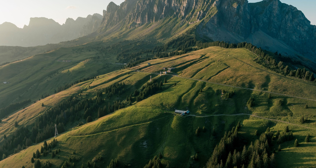
We start the hike at the Palfries mountain station. The Palfriesbahn cable car takes us up around 1,250 meters in just 12 minutes. The cable car travels over an impressive waterfall (Ragnatscher Bach) and takes us up to the Palfries plateau.
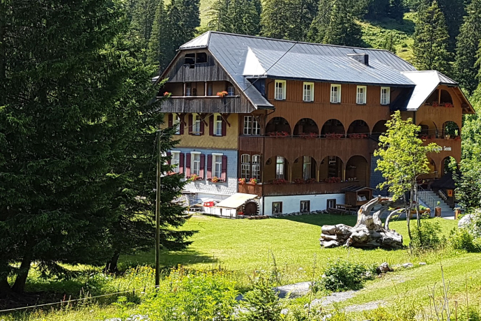
From the mountain station, the hike leads to the Palfries mountain inn, where we continue uphill towards Alvier after the parking lot. "In de Stei", the mountain trail branches off to the left and leads us via "Mürli" to Alp Malun. From there, the route leads over pastures and natural roads to the Hotel Kurhaus Sennis.
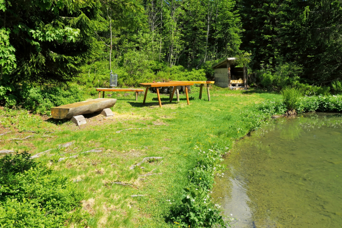
After a rest at the Hotel Kurhaus Sennis, our route leads us back to the Palfries mountain station, mainly on natural roads. The section from Alp Castilu to the Stralrüfi mountain restaurant leads over alpine pastures. - The small lake at the Hotel Kurhaus Sennis with the Swiss family fireplace invites us to linger.
Hidden Gem
Alternatively, a shuttle bus is available from the Hotel Kurhaus Sennis for the return journey to the Palfries valley station. The trip must be booked in advance (cable car valley station or directly at the Hotel Kurhaus Sennis). Departure is at 16.00 hrs or from the end of September at 15.00 hrs.
Equipment
Day hiking backpack (approx. 20 liters) with rain cover, sturdy and comfortable shoes, weather-appropriate and hard-wearing clothing in multiple layers, telescopic poles if necessary, sun and rain protection, provisions and drinking water, first aid kit, pocket knife, cell phone, headlamp if necessary, maps
Directions
From the Palfries mountain station, we hike 500 meters along the asphalted alpine road to the Palfries mountain inn. Immediately after the gravel parking lot, take the mountain path to the right towards Alvier. After about half an hour you reach "in de Stei" where you continue to the left. A wonderful mountain spring with the most diverse and beautiful alpine flowers can be experienced on the route to "Mürli" and on towards Alp Malun. The trail leads us across alpine meadows and through wetlands. The alp is accessible via a natural road from our chosen hiking destination. We follow this road for around 400 meters and then turn left onto another hiking trail.
At the "Schwamm" we reach the alpine access road again and follow it to the Hotel Kurhaus Sennis.
From the Kurhaus Sennis we hike back in the direction of Alp Malun. At the crossroads, take the path towards Schwamm. After Schwamm, the path leads us to the "Luegi" viewpoint. Here we are surprised with a view of the mountains, the Seeztal valley and Lake Walen. Our route continues in the direction of Alp Castilu. From there, we hike across pastures to the road towards Alp Älpeli, from where the hike continues towards the Stalrüfi mountain restaurant.
We follow the dirt road to the gravelled parking lot. Once we reach the Palfries mountain inn, we hike along the asphalted alpine road for approx. 500 meters to the Palfries mountain station.
Directions
Public Transport
Take the train to Flums or Sargans, continue by bus to the Heiligkreuz Ragnatsch stop. Take the Palfries cable car.
Travel Information
Take the highway exit Flums, then follow the main road in the direction of Sargans/Mels. The valley station of the Palfriesbahn is located in Heiligkreuz on the left-hand side of the road. The Palfriesbahn is signposted.
Parking
Public parking spaces available at the valley station of the Palfriesbahn (subject to charge)
Responsible for this content: Heidiland Tourism Ltd..

This website uses technology and content from the Outdooractive platform.

